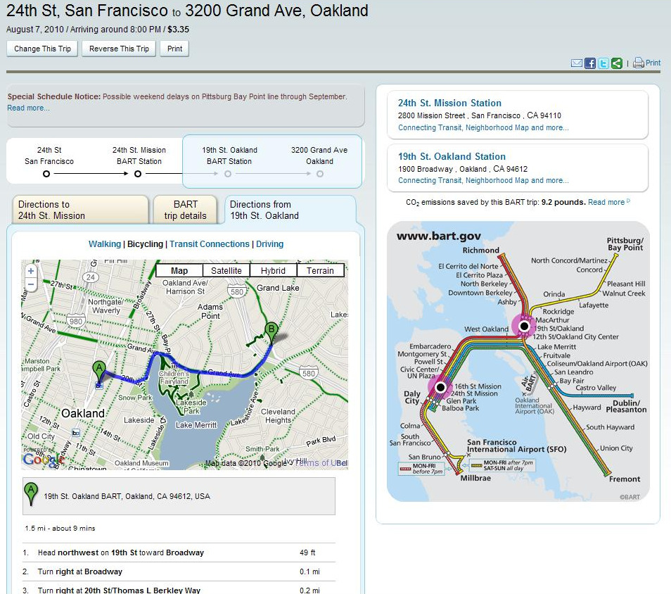
Looks like this went live today! BART.gov just launched a new revamped trip planner that uses the Google Maps API. Now there’s an address tab in the QuickPlanner that allows you to enter addresses (or cross streets) in addition to mere BART stations in order to plan your Bay Area trips more precisely.
The cool thing about it is that you can seamlessly add in bicycle and walking directions, which weren’t there before, and it overall works really well. This is currently the only implementation of its type live on a transit site, which makes it kinda cool and innovative . . . nice work dudes!
So, to help illustrate how it works, say I’m planning on seeing a Saturday movie at the classy Grand Lake Theatre in Oakland, and the movie starts at 8pm. I click on the address tab in the QuickPlanner, enter my address (or cross streets in this example, not that anyone would bother stalking me) in the start box, and then type “3200 grand, Oakland” [(address, city) or (street @ street, city) and yes, you have to actually type out "San Francisco", since "SF" alone is not sufficient lazybones] in the destination box, and viola!
The detailed screen above pops up and shows me when I should leave for the BART station (and how to get there, duh), as well as what line I should take. Then I can click on the bicycle tab to give me customized safe biking directions from the 19th Street station to the theatre, so I can finally see Inception like the rest of America. Thanks BART and Google!
Just don’t try using your Clipper Card . . .
