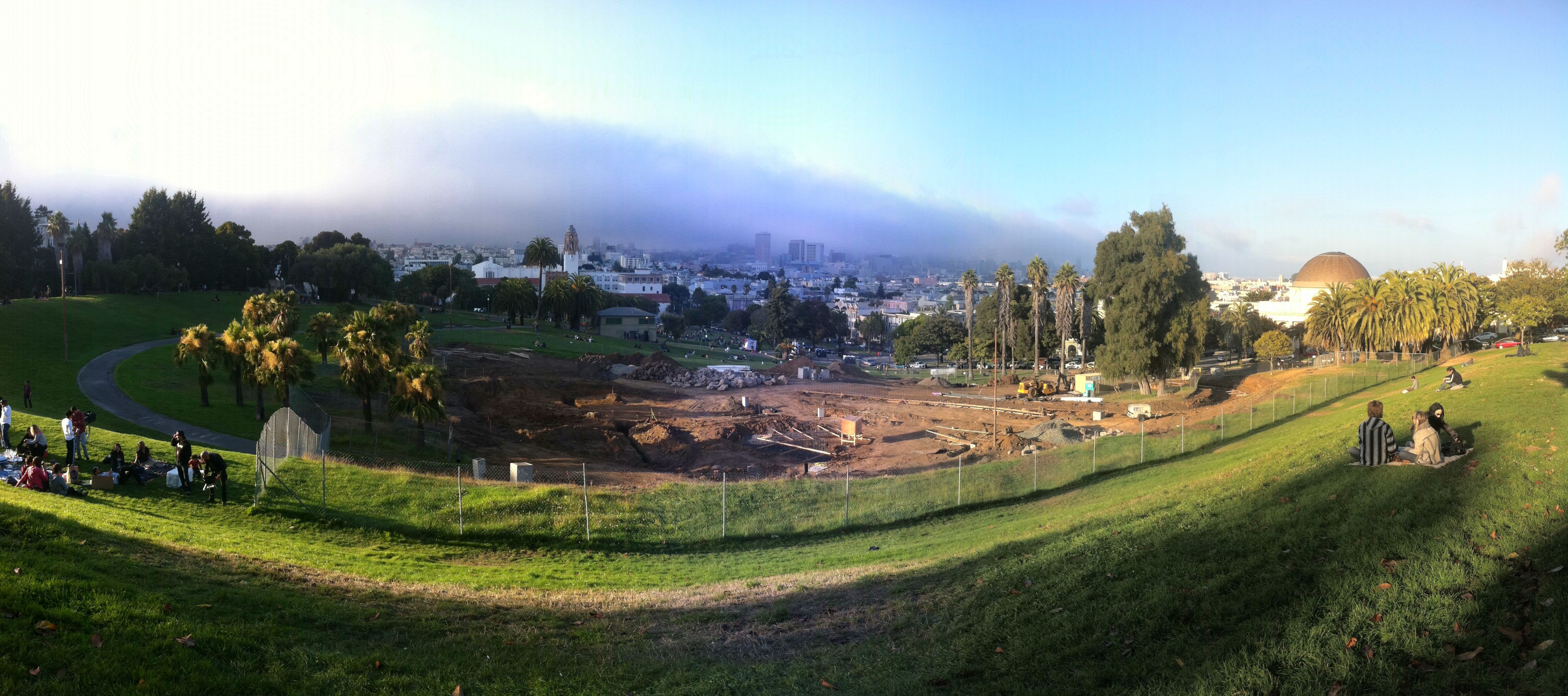
Dolores Park missile silo

Construction of the Bay Area’s newest launch facility is on time and under budget.

Dolores ICBM (click to zoom)

(I think we can all agree this is a better use of the park than the great strip miming travesty of ’11.)

Station SF-420 will be integrated into the Bay Area command and control system by summer.

Google Maps, 1853 Edition

Hey, look, a map of San Francisco!
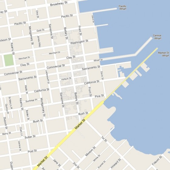
Waaaaait a second, something’s different about this. <insert Wayne’s World time travel music> It’s Google Maps, 1853! Behold PastMapper, an utterly epic work in progress on the part of @bradvertising, bringing the 1853 Coast Survey map to life and geotagging the 1852 city directory on top of it.

In the 1850s, the Mission was where you went to party and drink on the weekend. The Mission Plank Road (the curve of which BART follows today) was completed in 1851.
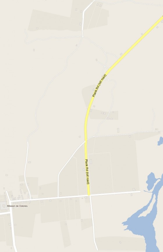
There was a toll — just 25 cents for riders on horseback, 75 cents for two-horse wagons, one dollar for a four-horse team! (What a bargain compared to BART or Muni.)

Well, not so fast — a dollar in 1853 was worth about $30 today. A glass of ale cost 12 and a half cents, and the typical fine for drunk/disorderly conduct was $5.  Needless to say, lots of folks hoofed it along side trails, cutting through the sand dunes and Hayes Valley.

Anyway, the 1853 is only the start for Pastmapper.  I have it on good authority that the much more expansive 1857/1859 Coast Survey map (with much more of the Mission) is on the to-do list.

Pastmapper: bringing you yesterday, today!

How to park your car in the Mission (in 1938)

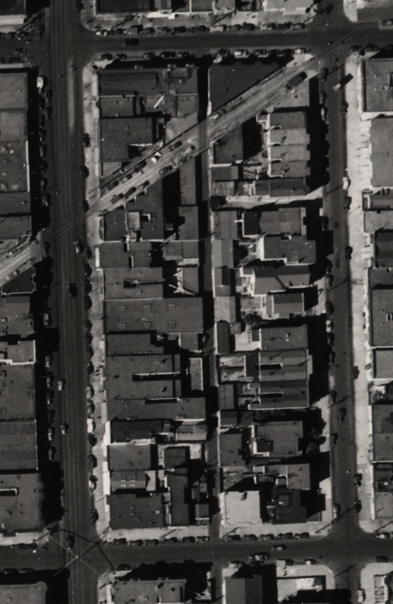
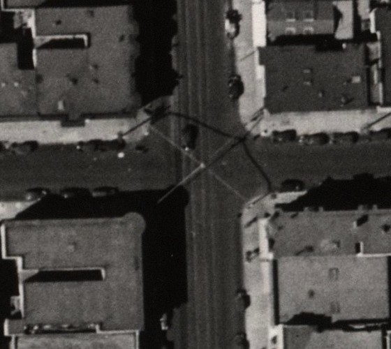
It’s 1938. You need to go shopping on the Miracle Mile but you can’t find parking between 24th and 25th. What do you do? Park in the Southern Pacific right of way, naturally.

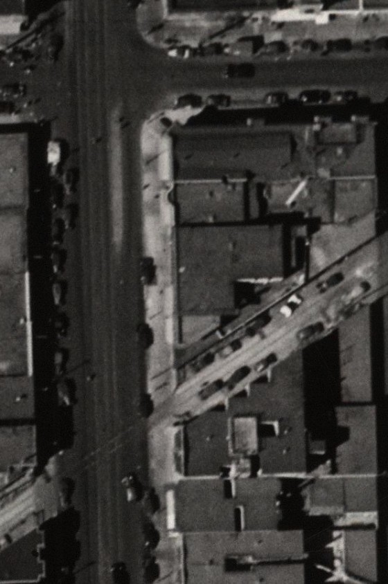
That’s 24th on top, 25th down below, Mission on the left and Capp on the right. Rosamunde now sits in the west side of the former tracks, and Foot Locker on the east side. And Killing My Lobster is doing a kickstarter to open up their theater space just to the south of the old tracks.

Zoom and enhance!

Given the less than precise angles of the parked cars, the train was obviously not running frequently in 1938 (though I do like to imagine it barreling through and knocking cars asunder.) In fact, Southern Pacific would give up the line by 1948.  Note that the railroad was originally built in the 1860s and pre-dated the Mission street grid by a few years.  It took its jaunty angle to avoid two horse race courses that were in the area.

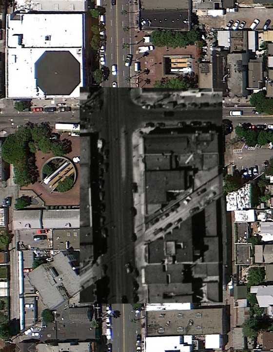
BurritoVision ON:

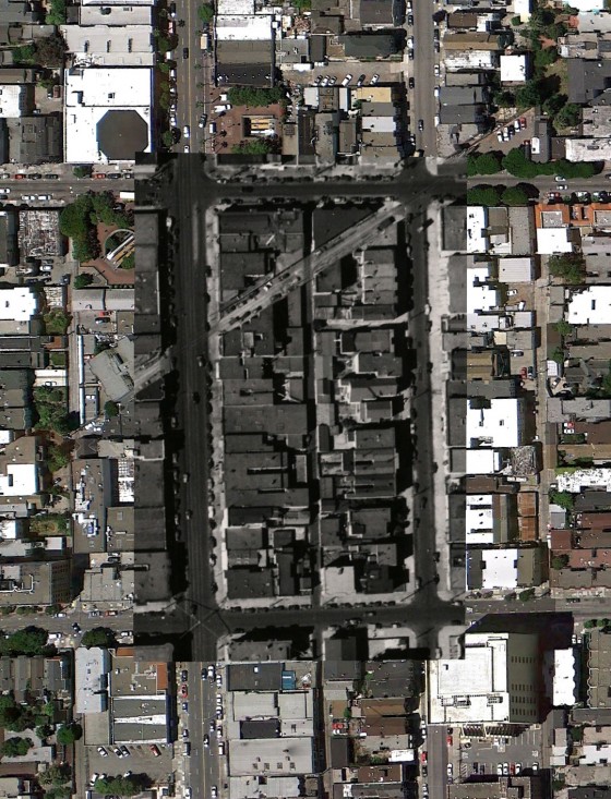
And a wider BV view. (The photos were taken at different angles so it doesn’t align as nicely as I’d like.)

Hmm, just noticed the arches over 25th and Mission:

I knew there were iron arches over Fillmore that were torn down during WWII, but not on Mission.

Anyway, do thank David Rumsey and the SFPL for being awesome. And I wrote more about it over here if you didn’t see it already.

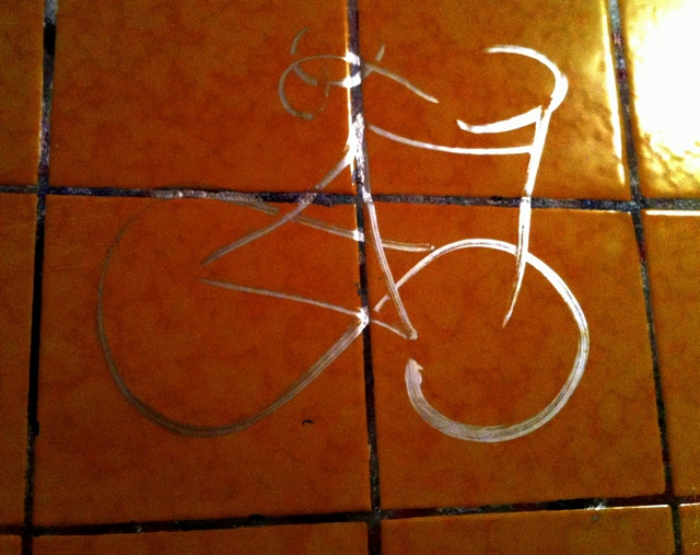
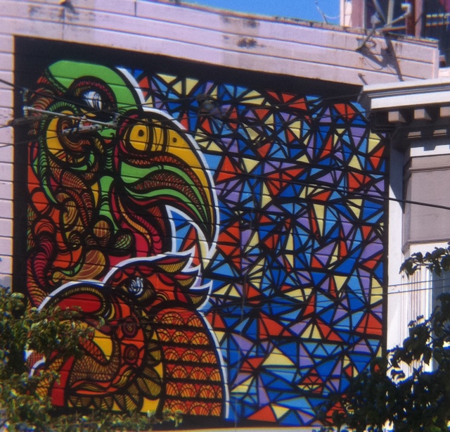
Gracycleffiti

Found on the bathroom wall of a secret pupuseria. So simple yet so shiny.

20110916-102553.jpg

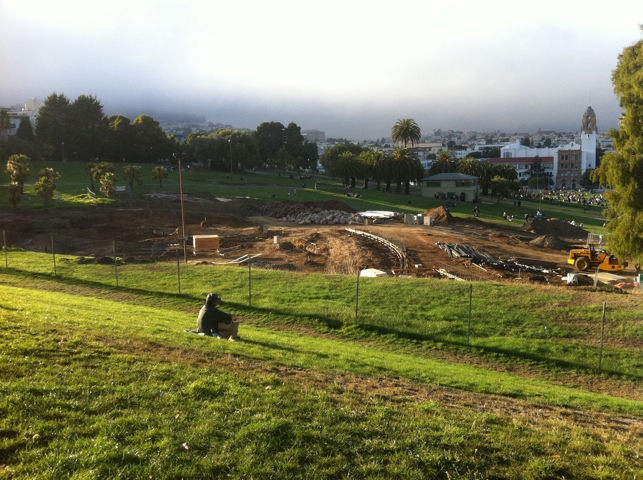
Dolores Park Strip Miming

In America’s desperate search for rare earth elements, no site is left unturned.

20110904-104400.jpg

That, or #burningmanrapture.

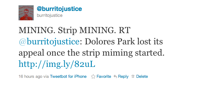
The “strip miming” typo was so unfortunate I had to share it with you all. I don’t even know how that would work. Naked with white paint? Peeling off imaginary clothes? Etymology over on Twitter:

And here’s a panorama for posterity’s sake.

20110904-104534.jpg

Pigeoneetos

Arlen captured this sad pigeon a few months back.

Could this explain the tragic pigeon cannibalism we see all too often in the Mission? Kind of like when hungry Looney Tunes characters see each other as dinner?

Though let’s be honest — this is in poor taste. Cheetos suck when compared to Hawkins Cheezies.

These are *so* much better than Cheetos you have NO IDEA. Hell, *I’d* eat a pigeon if it had a bag of Cheezies on its head.

(Also, the image search for Cheetos is pretty damn freaky.)

Goodbye pig, hello bird

Angry pig, begone!

20110714-075728.jpg

and here it is deskewed:

20110715-113938.jpg

Valencia St Victory

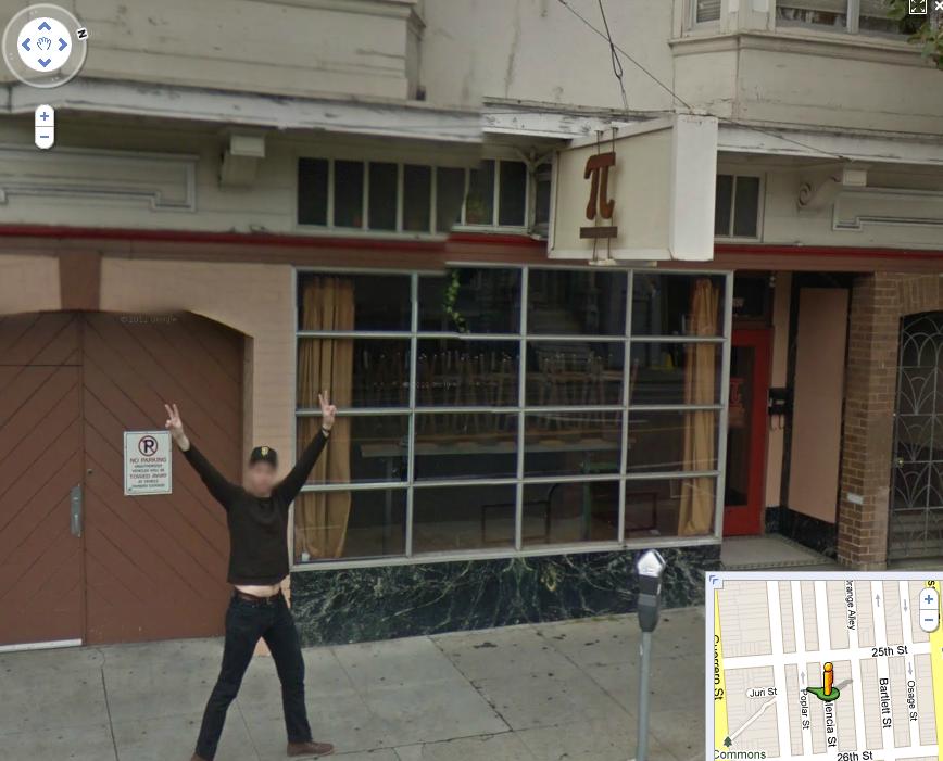
Neighboring Bernalwood alerts us to new Google Street View imagery!  Not only are Bernal and La Lengua out of the Google black hole, but the Mission has updated images.

This guy in front of Pi Bar was happy to see the Google Prius:

In fact, he held this pose for quite some time:

Most impressively, he managed to keep his feet in EXACTLY THE SAME POSITION as Google drove by, yet he continued to move down the sidewalk. That, my friends, is talent.

Mission & Fair drive-by?

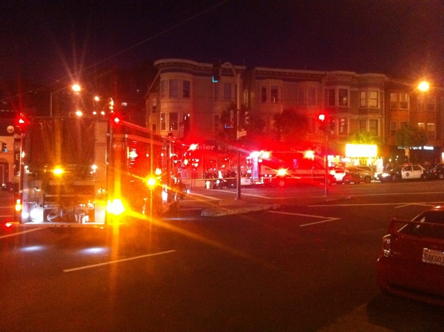
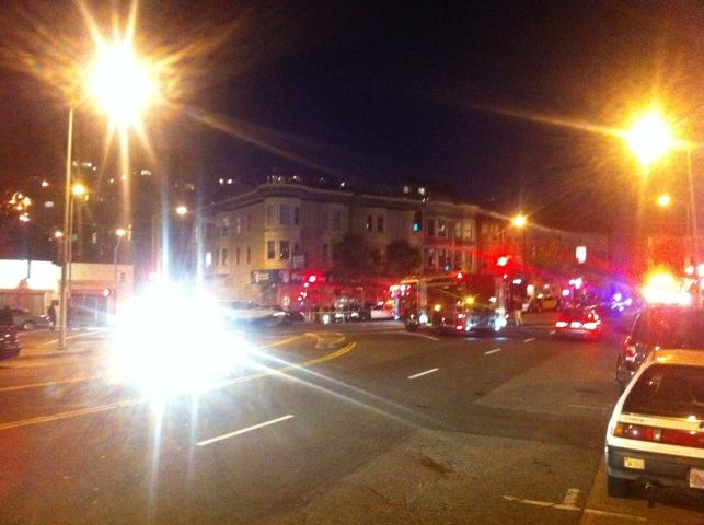
Someone just got shot at Mission & Fair. It happened pretty fast. I was across the street and thought it was a backfire until I saw a guy hopping away being helped by friends. It may have been a drive-by but I’m really not sure.

The good news was the cops were there in under a minute, and a pretty impressive response. Pictures below (sorry they are so light streaky but I had just ordered pupusas).

20110616-094218.jpg

20110616-114748.jpg

20110616-094241.jpg

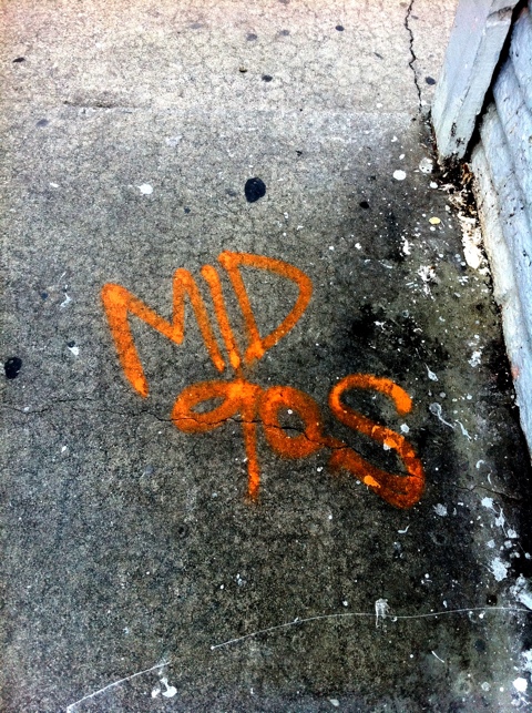
Mid 90s

I have no idea what this means. Is this a Debaser reference? A Minnesotan pining for home? Warning of a pending heat wave? A Tibetan or Burmese sympathizer? Just barely obtuse?

20110507-065918.jpg

Burrito Justice

Posts: 99

Email: mm-admin

Website: http://www.burritojustice.com

Biographical Info:

This author is a person who has been writing for Mission Mission for an amount of time. This person likes things--things like movies and pizza. This author is also involved with other exciting projects. When this author is not busy with his/her respective hobbies, this author enjoys having a good time with friends. If this author had to choose one adjective to describe him/herself, it would be "existing".