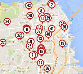
Curbed SF made it, and it’s interactive, so you must click here to use it. Handy-dandy!
There are 43 in all! Who knew!?
[via Sarah Lane]
Curbed SF made it, and it’s interactive, so you must click here to use it. Handy-dandy!
There are 43 in all! Who knew!?
[via Sarah Lane]
The blog so nice they named it twice.

You could probably overlay a map of Google bus stops and (like the overlay of Slothrop’s map of London and V2 hits in ‘GR’) find they match up quite nicely.
That’s probably because of the width of the roads to accommodate either….
Or you could overall this with a map of cafes and find out that parklets are really a cheap way for business to get outdoor seating.
This already existed courtesy of SF Planning department. The map put together by the city is far more complete than the Curbed listing. It includes not just Parklets but also the mobile versions and those in the works and other tactical items.
http://sfpavementtoparks.sfplanning.org/map.html