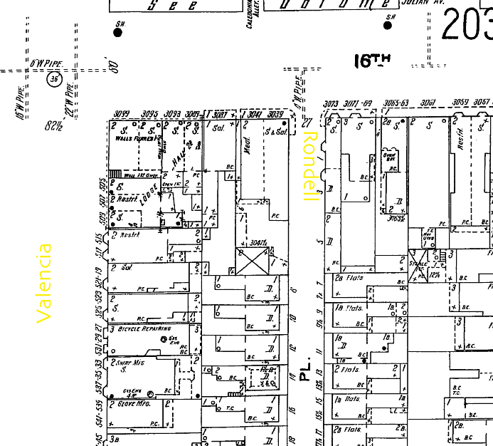
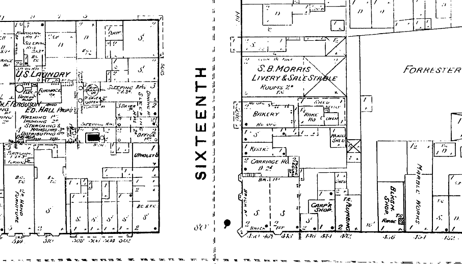
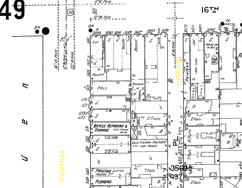
Colleen recently had occasion to take a look at some Sandborn Fire Insurance Maps:
I was looking something up in the fire insurance maps and on a whim looked up the Mission. I’ve attached a couple of screencaps–they’re fun to look at. There was a smithy at 16th and Mission and a Marble Works.
It’d be fun to do something to document all the previous uses of the buildings. I’ve looked into checking out all of the archaeological sites recorded in the area, but if I pulled the reports they’d make me sign a piece of paper that promises to never disclose them. Booo.
Thanks, Colleen! Click maps to enlarge them.


Oh man, I’d love to get my hands on some high res versions and align them to the street grid. Do you have the goods?
There was a brewery at the corner of 29th and Tiffany in the 1890s. Drink Eagle Brewery beer!
You can download all of them (1890-1950) from sflib if you have a library card. Sfgeneology has one set, can’t remember the year off the top of my head.
I’ve imported a couple into google earth, pretty cool — watch out though as the street width isn’t to scale, just the blocks. Shawn, given your fine geodigitological abilities (Shawn generated the at topo map I posted a while back) could you set up a geocoding app? Pick a map, mark and align the corners of a block, then geocode and tile? That way we could crowdsource it.
whoops, “at topo” equals “SF topo”. (Damn iPhone autoreplace.)
Oh, and there used to be a movie theater where the Mission Safeway is now up until the late 50s.
Oh wow, yeah—those Sanborn maps are gorgeous. Mike pointed out on the map with our office on it that the (kink.com) armory lot used to house a hospital.
These are definitely high res enough to do something interesting with. It looks like they’d require some serious pre-processing, though… extracting the bitmaps from PDFs, trimming out the wayfinding cruft in the margins, etc. The little compasses would be cool to see sprinkled throughout, though. Sounds like a good weekend project.
Sanborn maps are amazing; they’re what are used for the surveys of historic resources going on around the city right now. They’re often the best primary source record of a building’s age and original use. I thought only the San Jose State Univ library had a full set, but I could be wrong. Super awesome if you can get them all from SFPL!
[...] Mission Mission brings us several interesting posts today, including one of old fire insurance maps showing an old smithy and marble works at 16th and Mission, and another one which, well is just [...]