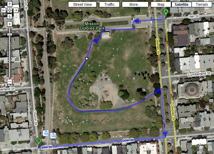
Today, Google Maps’ highly anticipated (especially here in the most walkable city in the world) “Walking Directions” feature is available to all users. It does let you plan a route through the pathways in Dolores Park, but as of yet, it doesn’t seem to realize pedestrians can walk on grass ![]()
Link. [via Google Blogoscoped]
Previously on Mission Mission:
Future View of Downtown from Dolores Park
Google Maps Street View Reveals Potentially Noxious Pink Gas Cloud Descending on the Mission

You can walk from Dolores Park to Williamsburg, Brooklyn:
http://maps.google.com/maps?f=d&hl=en&geocode=&saddr=dolores+park,+San+Francisco,+CA+94110&daddr=williamsburg,+brooklyn,+ny&sll=39.63457,-99.74713&sspn=55.182359,84.287109&dirflg=w&doflg=ptm&ie=UTF8&ll=40.178873,-98.173828&spn=54.812845,84.287109&z=4
But to stay awake for 43 days of non-stop walking you’ll probably lose yourself to meth before you get there. And your low-rise girl jeans won’t fit no more.
[...] Mission reader tack responded to the release of Google Maps Walking Directions with the following [...]